
A software tool developed by Glasgow researchers to monitor Scottish coastal erosion has proved its tech credentials in the tropical island off Indonesia.
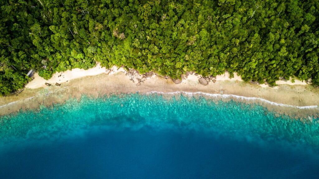
VedgeSat, originally tested in St Andrews and the Eden Estuary, has been used to monitor dense vegetation in five coastal sites spread across the island of Sumatra.
The sites were split between the muddy, mangrove-heavy city of Dumai on Sumatra’s east coast, and the sandy, grassland-dominated city of Padang on the west coast.
VedgeSat uses a pre-trained machine learning algorithm to classify every pixel of the satellite imagery as either ‘vegetation’ or ‘non-vegetation’, which enables it to establish the vegetation line in each site.
The tool’s results, which were validated against GPS surveys of Padang and high-res Planetscope images of Dumai showed that it performed very well in areas with dense vegetation.
It was capable of determining the vegetation line with errors of seven metres or less in sites which were thickly covered in mangrove trees, dense vegetation, or oil-palms in plantations, according to a new study.
Idham Nugraha, of the University of Glasgow’s School of Geographical & Earth Sciences and the Universitas Islam Riau in Indonesia, said: “This study provides the first benchmark for automated vegetation edge detection in tropical systems and demonstrates the scalability of satellite-based coastal monitoring.
“By enabling large-scale, repeatable, and cost-effective analysis, VedgeSat has the potential to support coastal management in data-scarce regions worldwide.”
Professor Larissa Naylor, a co-author of the paper, said: “As climate change intensifies and destructive storms become more common, our coasts will be affected in ways that can be difficult to predict in advance.”
“More than a tenth of the world’s population live in coastal areas, putting homes, businesses, infrastructure and wildlife all under threat from the effects of climate change. Our aim in building VedgeSat was to make it easier and cheaper for decisionmakers to map their changing coastlines, and make more informed and impactful choices as a result”, said paper co-author Dr Martin Hurst.
The platform uses artificial intelligence to analyse public satellite imagery of coastlines and spot the tell-tale fingerprints of coastal change by identifying the vegetation edge – the line where plants begin growing closest to the water.
Since plants can only grow in places where they won’t be flooded by seawater, identifying the vegetation edge can help pinpoint where the land can support long-term growth.
Monitoring the vegetation edge over time can show whether coasts are eroding, which moves the edge inland, or growing, which pushes the edge towards the sea.